Seasonally active weather pattern continues
Posted on December 6, 2024 by Greg Soulje
Source: Farm Progress. The original article is posted here.

Here's your latest weather forecast as of Dec. 6, 2024.
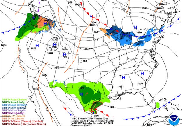
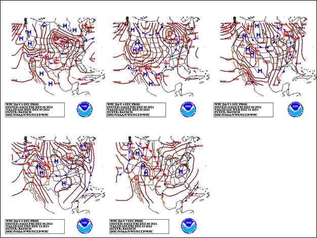
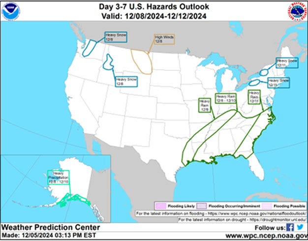
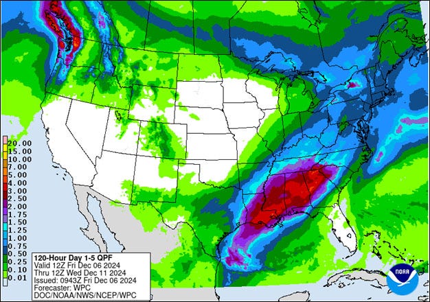
The primary U.S. weather-maker during the next five days will be a storm system traversing the nation’s northern tier, starting on Saturday in the Pacific Northwest and reaching Lake Superior by Monday night.
Greg Soulje
A wave of low pressure along the storm’s trailing cold front will enhance precipitation across much of the eastern U.S. during the early to middle part of next week.
Greg Soulje
Five-day rainfall totals should reach 2-4 inches or more from the central Gulf Coast to the southern Appalachians. Snow with the system will initially be limited to the North, although parts of the Midwest and Northwest will experience accumulations next week, as colder air is drawn into the system.
Greg Soulje
Elsewhere, mostly dry weather will prevail during the next five days from California to the central Plains and western Corn Belt.
Greg Soulje
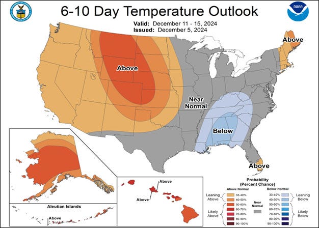
Looking ahead, the 6- to 10-day outlook calls for the likelihood of near- or above-normal temperatures nationwide, except for cooler-than-normal conditions in portions of the Southeast.
Greg Soulje
Meanwhile, near-normal or below-normal precipitation across most of the country should contrast with wetter-than-usual weather across the Northwest, along the Atlantic Coast and in parts of Texas.

Clark County Feeders is a BQA Certified 655-acre feed yard and grain storage facility specializing in beef cattle custom feeding and grain purchase, storage and sales.
.jpg?disable=upscale&width=1200&height=630&fit=crop)