Record-setting warmth covers northern half of Plains
Posted on January 12, 2026 by Greg Soulje
Source: Farm Progress. The original article is posted here.

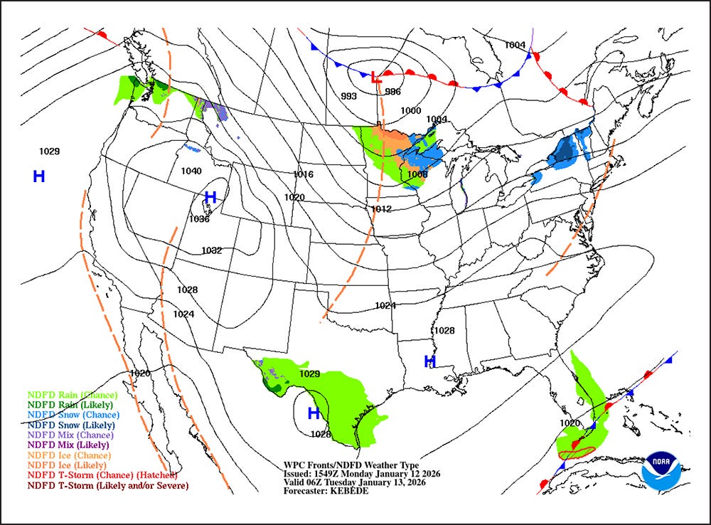
Across the Corn Belt, seasonably cool weather lingers in the Ohio Valley and the Great Lakes region. Meanwhile, unusual warmth prevails west and south of the Missouri River; Monday’s maximum temperatures will exceed 55°F throughout Nebraska.
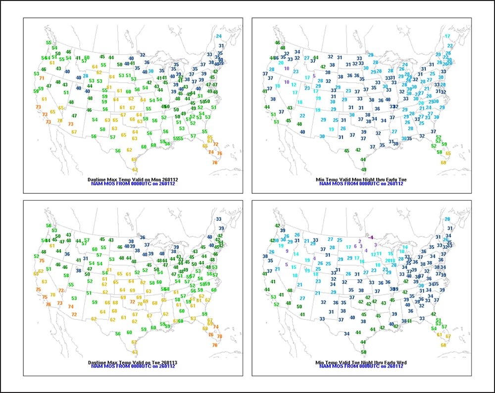
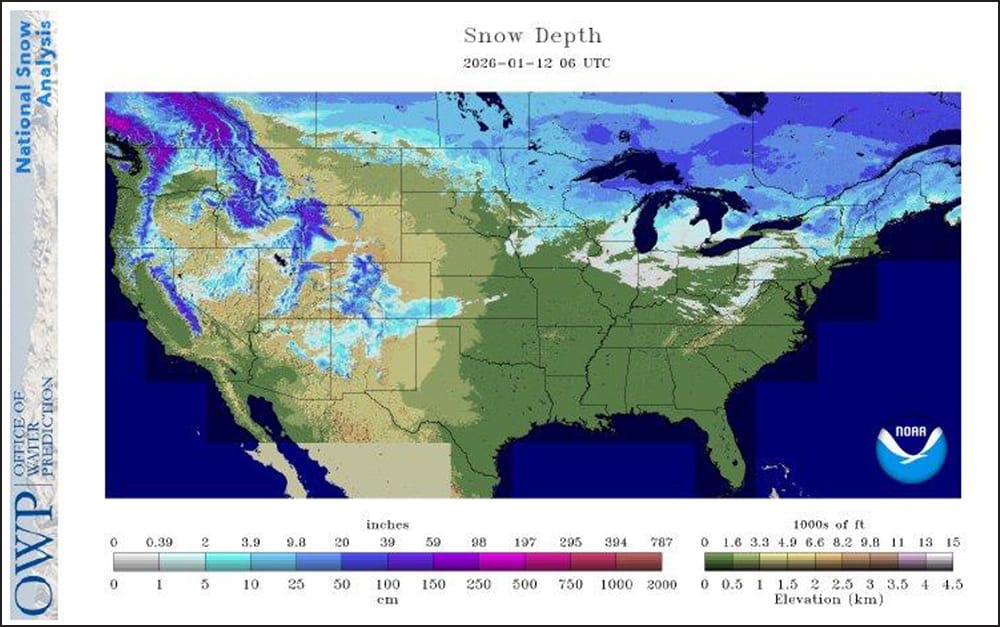
On the Plains, record-setting warmth covers roughly the northern half of the region; Monday’s high temperatures will reach 60°F or higher as far north as central Montana and western South Dakota. Meanwhile, any remaining snow cover across southwestern Kansas, southeastern Colorado and neighboring areas is quickly eroding.
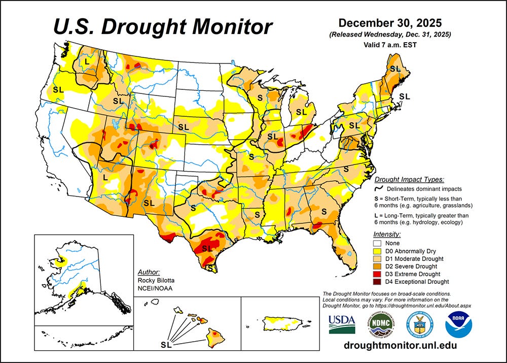
In the South, light freezes were noted early Monday as far south as the northern tier of Florida. Cool, dry weather also cloaks the remainder of the South, following recent rainfall that provided variable relief in drought-affected areas.
In the West, mild, dry weather prevails, aside from showery conditions in northwestern Washington and patchy fog in Oregon, Idaho and California’s San Joaquin Valley. With much of the West entering a protracted dry spell, water supply concerns are mounting in areas—such as the Four Corners States—reporting below-average snowpack for mid-January.
Dry weather and above-normal temperatures will cover the western U.S. for the remainder of the week, with any northwestern precipitation ending later Monday.
Related: Farm Progress America, January 23, 2026
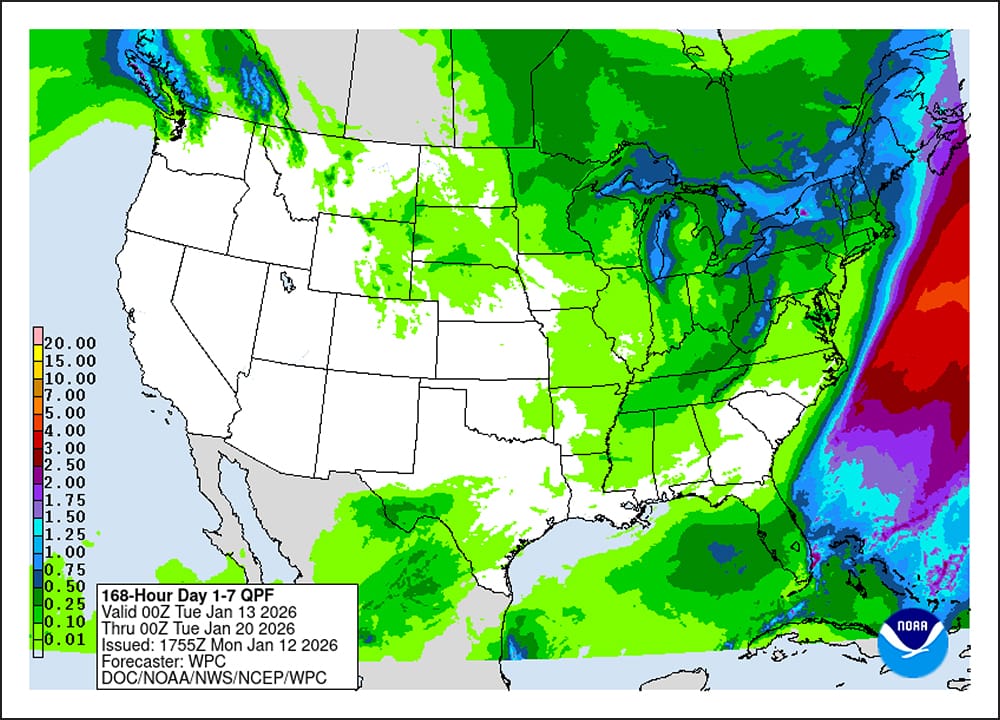
Farther east, however, a complex weather system will coalesce, leading to light or moderately heavy precipitation across the eastern half of the U.S. Some of the most significant snow should fall on Thursday across the central and northern Appalachians.
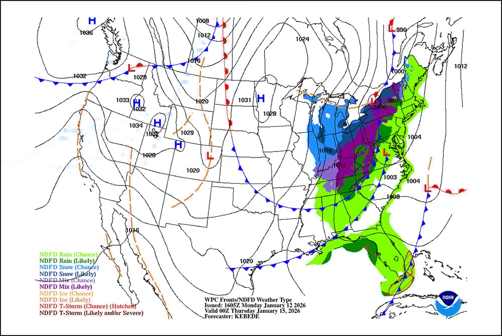
At times, heavy snow may also blanket portions of the Great Lakes region. Midweek rain showers across the South will be mostly light.
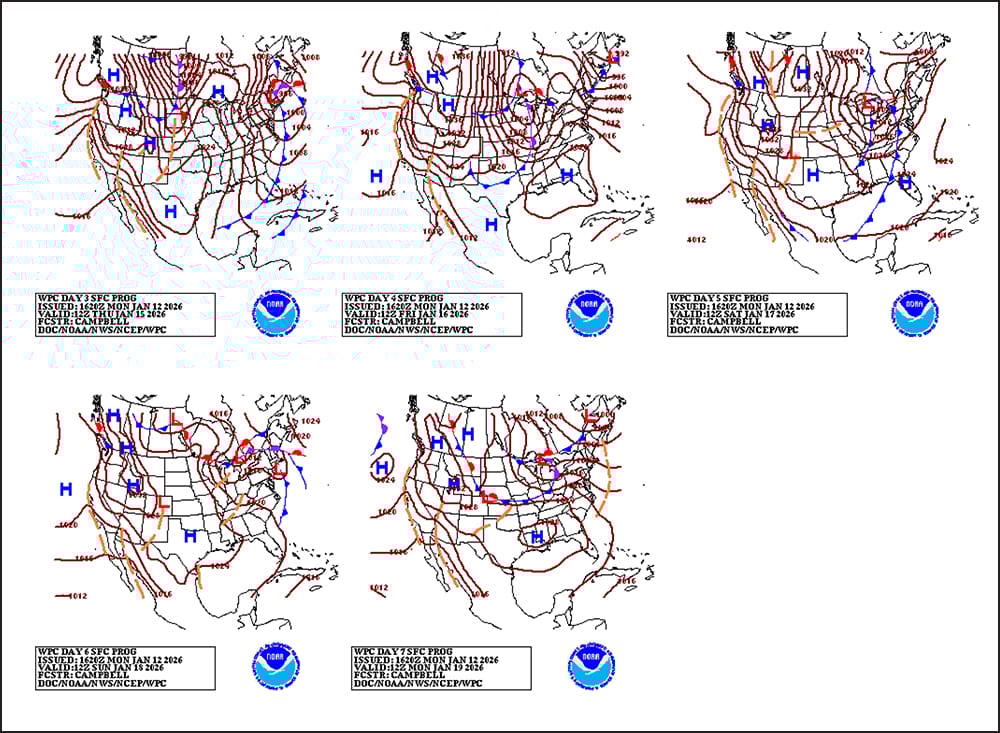
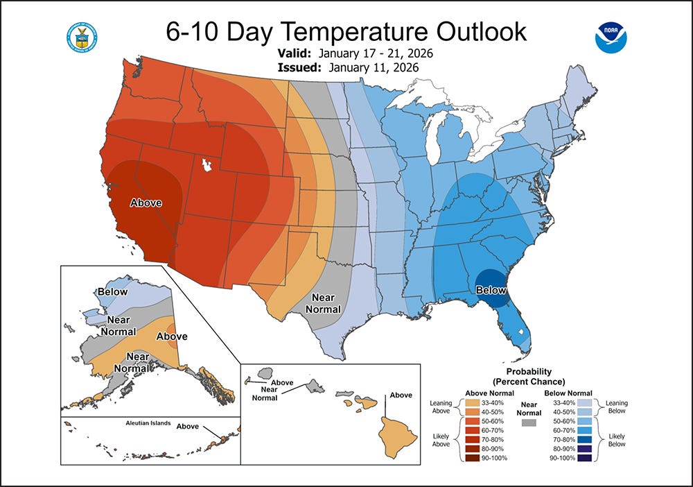
Looking ahead, the 6- to 10-day outlook calls for below-normal temperatures across the eastern half of the U.S., while warmer-than-normal weather will prevail from the Pacific Coast to the High Plains.
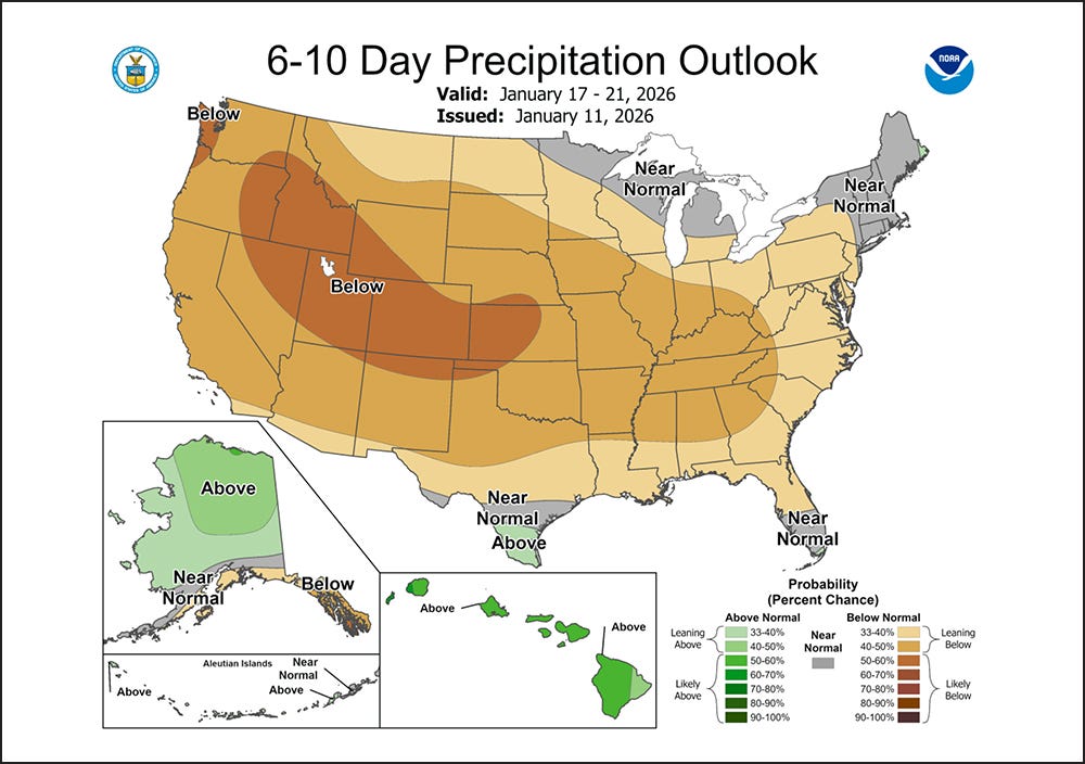
Meanwhile, drier-than-normal conditions will dominate the country, with near- or above normal precipitation limited to New England, southern sections of Florida and Texas and the upper Great Lakes region.

Clark County Feeders is a BQA Certified 655-acre feed yard and grain storage facility specializing in beef cattle custom feeding and grain purchase, storage and sales.
.jpg?disable=upscale&width=1200&height=630&fit=crop)