Early-January weather generally mild, tranquil
Posted on January 7, 2026 by Greg Soulje
Source: Farm Progress. The original article is posted here.

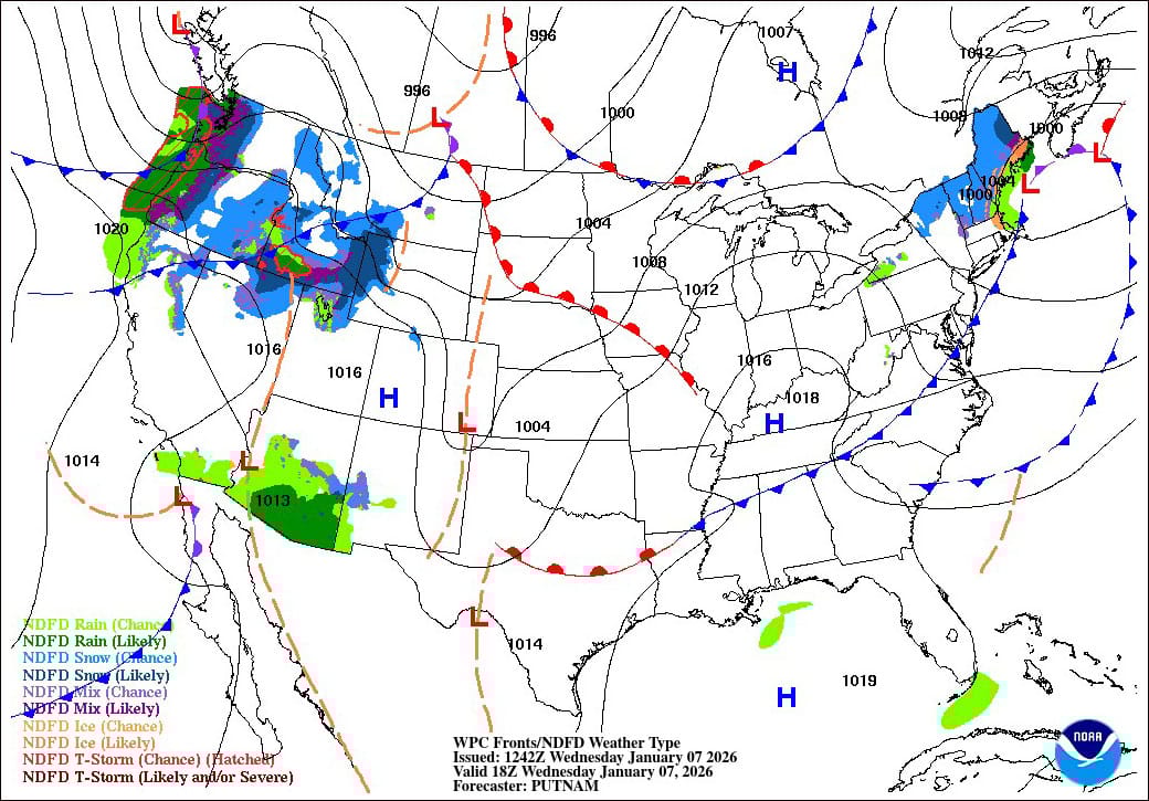
Across the Corn Belt, precipitation across the Great Lakes region has ended, although cloudiness lingers. With a sharp midwestern temperature gradient in place, Wednesday’s maximum readings will range from near 35°F in the vicinity of the Great Lakes to 60°F or higher in much of Nebraska, Missouri and southwestern Iowa.
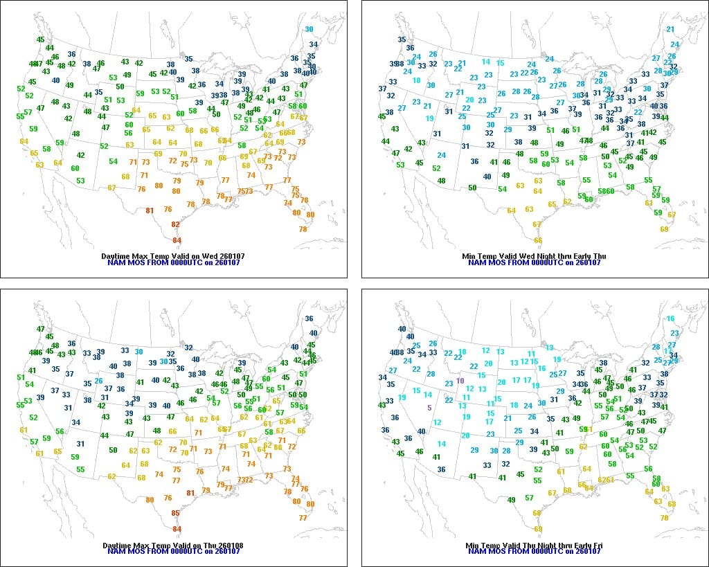
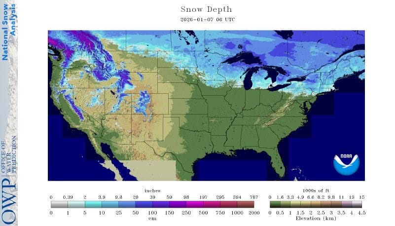
On the Plains, unusual warmth continues, with any meaningful snow cover limited to the northeastern corner of the region (e.g. northern and eastern North Dakota). Snow-free conditions are favorable for livestock but have left the winter wheat crop exposed to potential weather extremes. Wednesday’s high temperatures should reach 60°F as far north as western South Dakota.
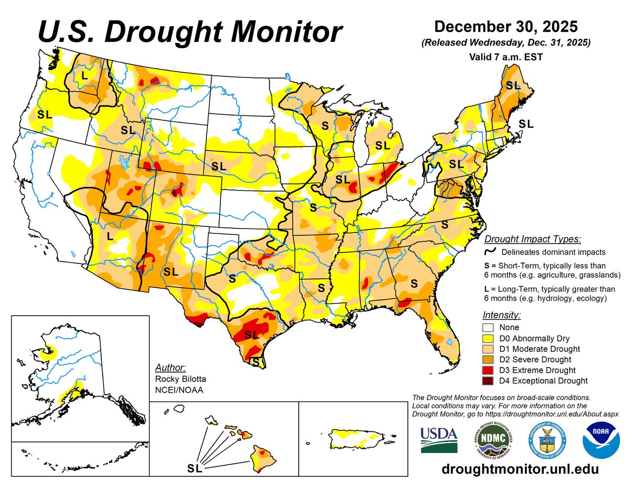
In the South, warm, dry weather continues to promote off-season activities, including mending of fences and other farm maintenance. However, locally significant drought is resulting in numerous impacts, including poor pasture conditions, low streamflow and reduced availability of surface water from springs and ponds. Some of the most notable drought impacts related to hydrology are being observed across northern Florida and southern Georgia.
In the West, a final round of northwestern storminess has pushed inland as far as the northern Rockies. Cooler air has overspread portions of the Pacific Coast States, but mild, dry weather covers the remainder of the West. In the wake of recent storminess, the average water equivalency of the Sierra Nevada snowpack has increased to nearly 10 inches, about 90% of normal for the date. However, snowpack continues to languish in many other areas of the western U.S., except the northern Rockies and environs.
Related: Cattle markets plunge on false New World screwworm rumors
Over the next few days, active weather will gradually shift from the West to the central and eastern U.S. Through Thursday, however, additional precipitation could total 1 to 2 inches or more in the Pacific Northwest and portions of the Four Corners states.
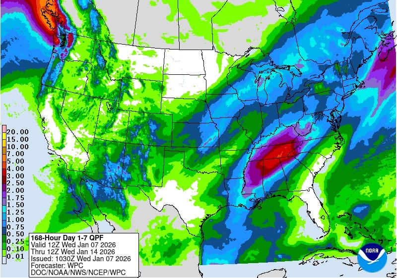
On Thursday, the first of back-to-back storm systems will develop across the central Plains. By late Friday, as the initial system departs the Great Lakes region, a trailing storm will develop across the mid-South. Snow with the lead storm will be mostly limited to the central and southern Rockies, but the latter system has the potential to produce significant, late-week snowfall in portions of the Midwest.
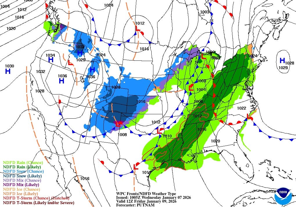
Heading through the weekend, mild, dry weather in the West will contrast with colder, breezy conditions east of the Rockies in the wake of departing storminess.
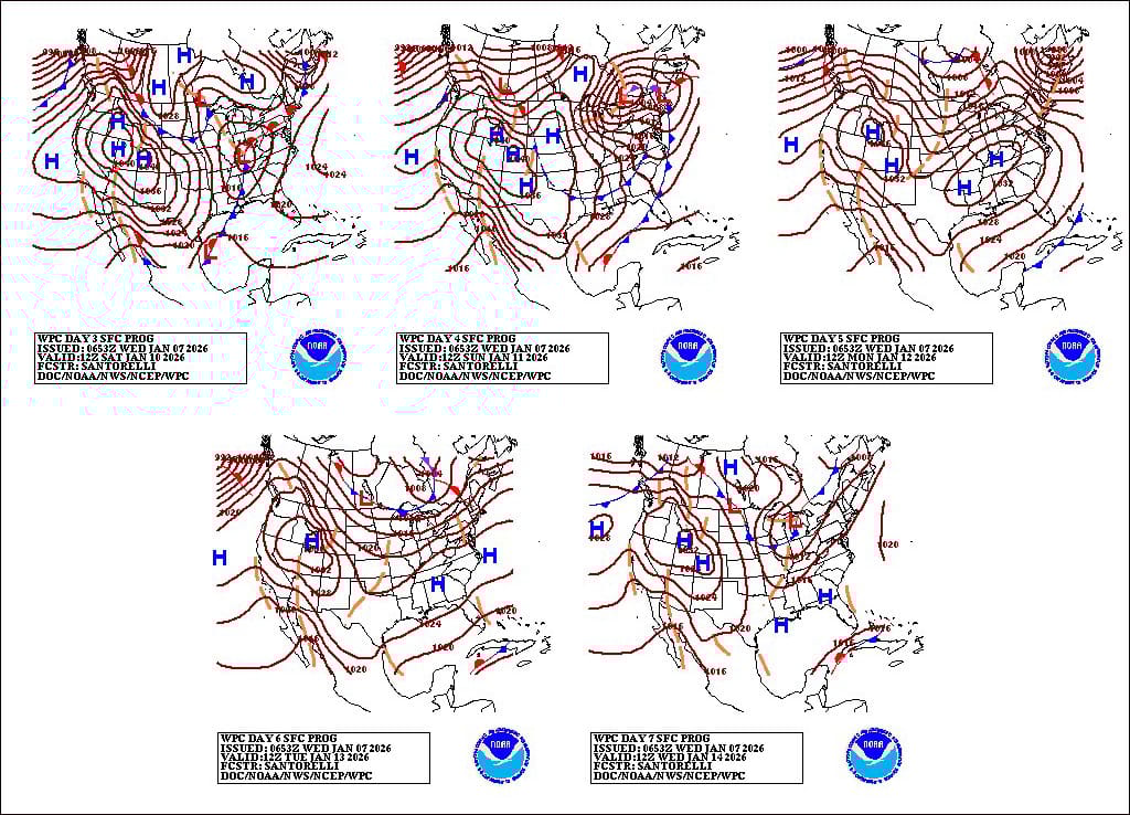
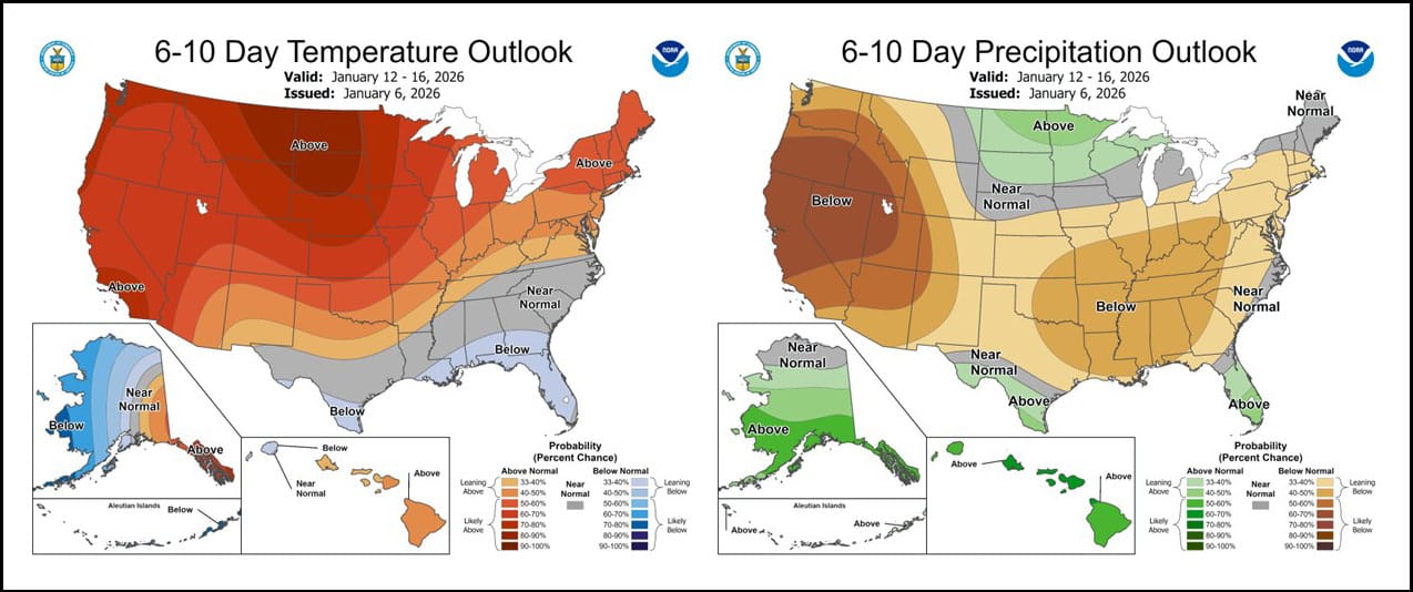
Looking ahead, the 6- to 10-day outlook calls for the likelihood of near- or above-normal temperatures and near- or below-normal precipitation across most of the country. Cooler-than-normal conditions will be confined to areas along and near the Gulf Coast.
Related: Food prices, economic strain reshaped grocery shopping in 2025
Meanwhile, wetter-than-normal weather should be limited to the lower Rio Grande Valley, peninsular Florida and portions of the north-central U.S.

Clark County Feeders is a BQA Certified 655-acre feed yard and grain storage facility specializing in beef cattle custom feeding and grain purchase, storage and sales.
.jpg?disable=upscale&width=1200&height=630&fit=crop)